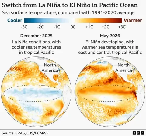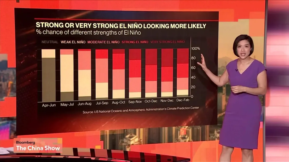
El Niño has officially formed in the tropical Pacific Ocean, confirmed by the US National Oceanic and Atmospheric Administration (NOAA) and Japan Meteorological Agency as of June 11, 2026 [1, 2, 3, 4, 5, 6, 7]. The phenomenon is defined by sea surface temperatures at least 0.5°C above average in a key Pacific region combined with atmospheric changes such as shifting winds [1, 3, 8]. NOAA forecasts a 63% chance that a very strong or "super" El Niño, with sea surface temperatures rising 2°C or more above average, will occur between November 2026 and January 2027 [1, 2, 9, 3, 4, 5, 6, 8, 7].
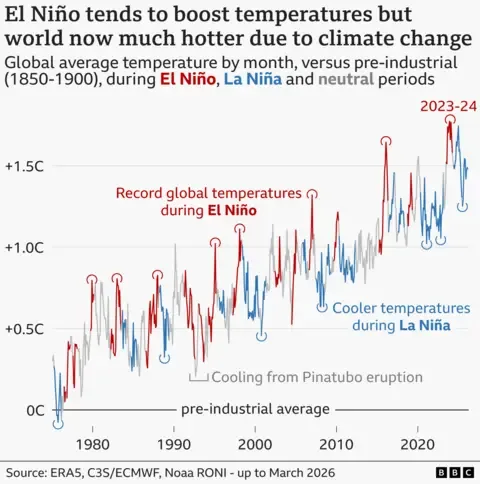
This El Niño event is expected to be among the strongest recorded since 1950, potentially rivaling or exceeding the historic 1997-1998 event [2, 9, 4, 5, 8, 7]. NOAA meteorologist Tim said, "El Niño phenomenon has arrived and could be one for the record books" [7], while weather agency meteorologist Haley Thiem said, "El Nino is here, and it could be one for the history books" [4]. Prof Adam Scaife of the UK Met Office warned, "We do need to worry about the impacts. The current El Niño is… riding on top of a substantial amount of global warming. This means that the actual temperatures in affected regions could well be unprecedented, as the warming from El Niño is being topped up by climate change" [1].
El Niño typically releases ocean heat into the atmosphere, raising global temperatures by around 0.2°C above long-term human-driven warming [1, 3, 8]. Abby Frazier, a climate scientist at Clark University, explained, "The warm, deep waters of an El Niño affect weather patterns by bringing a lot of extra heat to the surface, fueling a lot of extreme events for a lot of places around the world. Especially in the Pacific, it can get dire very quickly" [5].
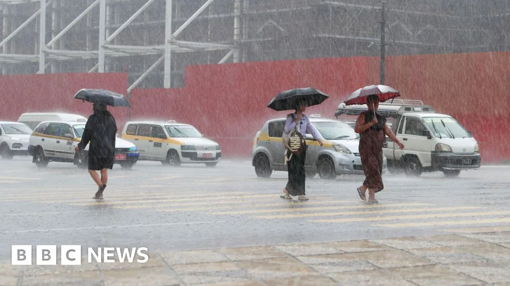
Expected weather effects include increased risks of droughts, floods, heatwaves, wildfires, and altered tropical rainfall around the world [10, 2, 5, 11, 7]. El Niño tends to suppress Atlantic hurricane activity but may increase Pacific hurricane risk [2, 5, 8]. Regions especially vulnerable include western South America, India, Australia, East Africa, and parts of Central America [2, 3, 7]. The Indian Meteorological Department warned on June 12 that the Indian monsoon season could experience disruptions with impacts on rainfall and crops [12]. Extreme heat already seen in South Asia and Pakistan is linked to ongoing El Niño formation [11].
United Nations Secretary-General António Guterres called El Niño an "urgent climate warning," saying it "will pour fuel on the fire of a warming world" [2, 5, 7]. Mohamed Adow of Power Shift Africa cautioned, "This is not just another weather forecast; for millions of people, it is a deadly warning. It means less rain, crop failures, food price hikes, and many families pushed to the brink of survival" [6].
Some agencies use stricter criteria. Australia’s Bureau of Meteorology requires sea surface temperatures of 0.8°C above average to declare El Niño and has not officially done so as of early June 2026 [3]. El Niño events typically occur every 2 to 7 years lasting 9 to 12 months, peaking late in the year or early next year [3, 7].
NOAA’s forecast for a potentially very strong El Niño peaks from November 2026 through January 2027 and will be closely monitored for impacts worldwide [1, 2, 3, 6, 7].