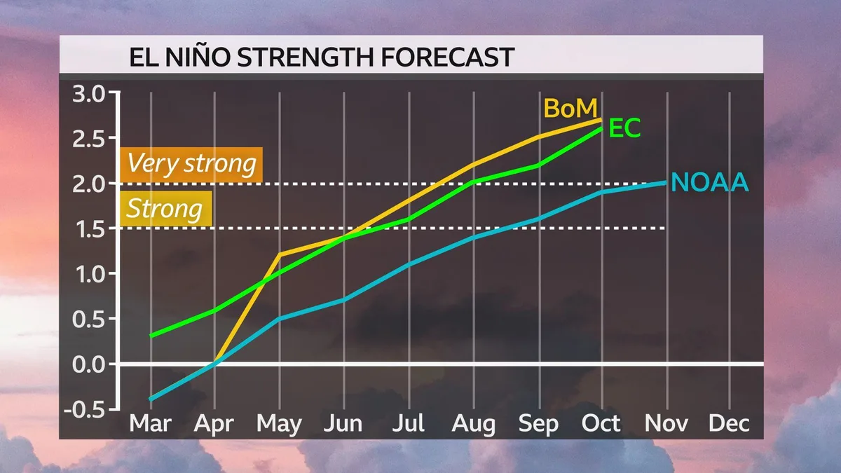
The tropical Pacific Ocean is warming rapidly, with sea surface temperatures currently about 0.5°C above normal, signaling the onset of El Niño in May 2026 [1]. NOAA indicates a roughly 60% chance that El Niño will emerge between May and July and persist through the end of the year [2]. The climate pattern is expected to strengthen to a strong or super El Niño by autumn or winter 2026 [1, 2].
NOAA foresees a two-in-three chance that the event will be strong or very strong by winter, with some climate models predicting sea surface temperature rises over 2.5°C—the threshold for a "super" or "Godzilla" El Niño—by autumn [1, 2]. A super El Niño is defined by a rise of more than 2.0-2.5°C above the long-term average in the central equatorial Pacific [1, 2].
However, some models expect only a strong but sub-super event around 1.5°C above average, presenting a divide among forecasts [2]. Climate scientist Dr. Koh Tieh Yong noted, "Presently, it is still in the neutral phase, which means the event will emerge in the next one to two months and intensify rapidly, as strong El Niños tend to do" [2]. He predicts the event will reach about 1.5°C by the last quarter of 2026 [2]. NOAA meteorologist Nathanial Johnson described the rapid shift as "a 'rare occurrence' should it continue at the current pace - going from La Niña to a potentially strong El Niño within a year" [1].
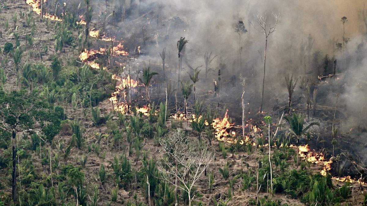
Super El Niños bring drier and hotter conditions to many regions. Southeast Asia is vulnerable to intense forest fires and haze due to such events [2]. Singapore’s Minister for Sustainability and the Environment Grace Fu warned on May 7 that a "Godzilla" El Niño could trigger more severe haze and fires in Southeast Asia later this year [2, 3, 4, 5, 6]. Past super El Niños in 1982-83, 1997-98 and 2015-16 were linked to severe haze episodes and heatwaves in the region [2].
In Singapore, a heatwave is declared when maximum temperatures reach 35°C on three consecutive days, a threshold that could be approached with the warming expected during a strong El Niño [2].
Sea surface temperatures near 0.5°C above average this week represent an early signal for El Niño’s onset [1]. NOAA’s forecast calls for El Niño to emerge between May and July with a 60% chance and continue through year-end [2]. The period of peak warming and potential maximum event strength is projected for autumn 2026, with the event fully developing by the last quarter [1, 2].